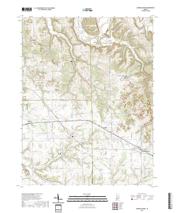
2022 Map of Campbellsburg
USGS Topo · Published 2022About this map
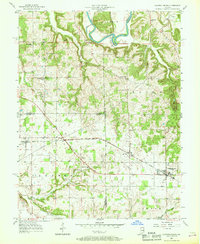
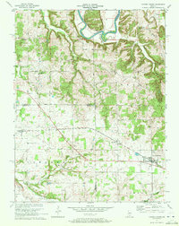
The CSX railroad corridor serves as the industrial spine for southern Indiana towns like Campbellsburg and Saltillo, following a path that skirts the edge of the Mitchell Plain. This karst landscape is defined by its subtle drainage patterns, where surface waters like Fishing Cr and Carters Cr eventually feed into the East Fork White River or the Lost River system. The map documents a predominantly rural fabric where small settlements such as Leipsic and Bono persist alongside numerous family and community burial grounds, including Freedom Cem and Talbott Cem. The northern boundary is sharply defined by the winding course of the White River, featuring the prominent Horseshoe Bend, which has historically dictated local road networks and land divisions across the Lawrence, Washington, and Orange county lines.
Find a feature on this map
116 named features on this map. Tap any name to fly to it.
Don’t see what you’re looking for? This feature index may not catch every label — zoom into the map to look around manually.
Map Details
Editions of this 2022 Campbellsburg Map
This is the sole edition of this map. No revisions or reprints were ever made.
Historical Maps of Fairview Through Time
3 maps found