Old Maps of Washington County, Indiana
Explore 130 old maps of Washington County, spanning from 1934 to today. These high-resolution historic maps reveal how streets, neighborhoods, landmarks, and natural features evolved over time — perfect for genealogy, metal detecting, research, and local history exploration.
What you can do with these maps:
- See how Washington County changed over time: Compare historical maps to modern-day views to trace roads, homesites, rail lines & more.
- View detailed metadata: Each map includes creators, publishers, year, scale, and archive source.
- Overlay maps with satellite & LiDAR: Visualize the past alongside modern tools to explore terrain & human change.
- Trusted historical sources: Maps sourced from the USGS, Library of Congress, and other archives.
- Access maps your way: View online, download high-res files, or order prints for personal or research use.
Start exploring old maps of Washington County to uncover forgotten places, hidden landmarks, and the deep history beneath your feet.
Washington County, IN maps
(130)- 1934 Map of Bedford
 1934 Bedford1934 Print · USGSLawrence County's limestone district and the winding White River valley are detailed here during the mid-1930s. Genealogists and researchers can trace local families through many rural landmarks, including Sherril Cem, Leesville, and the Peerless Quarry.2 unique versions available
 - 1937 Map of Bedford
 1937 Bedford1937 Print · USGSLawrence County limestone country is seen here in the late 1930s, defined by its massive quarries and river-valley railroads. Genealogists can trace family landmarks and rural life at the County Farm, Leesville, and the United Brethren Ch.2 unique versions available
 - 1941 Map of Borden
 1941 Borden1941 Print · USGSIn the hills of Clark and Floyd counties just before the war, small crossroads like Navilleton and Starlight were the heart of rural life. Genealogists can trace early homesteads through family landmarks like Fisher Cem and Goss Sch near the Muddy Fork railroad line.
 - 1947 Map of Hardinsburg, 1966 Print
 1947 Hardinsburg1966 Print · USGSSouthern Indiana's rural landscape is captured here in the late 1940s, showing a patchwork of small farms and family-named creek crossings. Genealogists can trace family roots at Oak Grove Ch, Walton Cem, and early schools like School No 6.
 - 1949 Map of Hardinsburg
 1949 Hardinsburg1949 Print · USGSSouthern Indiana at the end of the 1940s reveals a patchwork of rural school districts and county-line settlements. Genealogists can trace family footprints across Hardinsburg and Marengo or find ancestral sites like Old Unity Cem and Baptist Hill Ch.2 unique versions available
 - 1949 Map of Henryville
 1949 Henryville1949 Print · USGSSouthern Indiana's timbered hills and rural townships are captured here just after the war, showing the deep integration of state conservation and local settlement. Trace family roots at Mt Zion Ch and Mountain Grove Cem, or follow the Pennsylvania rail line through Henryville and Underwood.2 unique versions available
 - 1950 Map of Salem
 1950 Salem1950 Print · USGSWashington County at mid-century centers on the industrious town of Salem and the winding Blue River valley. Family historians can trace rural roots at Old Blue River Cem, Canton, and the Pierce Consolidated Sch along the Monon rail line.2 unique versions available
 - 1950 Map of Becks Mill
 1950 Becks Mill1950 Print · USGSWashington County at the start of the 1950s shows a landscape of small farming townships and vital rail connections. Researchers can locate family roots at Becks Mill, trace the path of the Chicago Indianapolis and Louisville railroad, or find rural landmarks like Mount Tabor Ch and Texas Sch.
 - 1950 Map of Palmyra
 1950 Palmyra1950 Print · USGSMid-century Harrison and Washington counties are documented here at a time when small rural settlements like Martinsburg and Palmyra anchored the local landscape. Genealogists can trace family footprints through sites like Snyders Chapel, Miller Cem, and the Morgan Township Sch.2 unique versions available
 - 1951 Map of Smedley
 1951 Smedley1951 Print · USGSWashington County at the start of the 1950s shows a rugged interior of ridges and hollows defined by the Chicago Indianapolis and Louisville rail line. Researchers can trace rural life through landmarks like Prowsville Cem, Oxonia (Hitchcock Sta), and several country schoolhouses.3 unique versions available
 - 1953 Map of Fredericksburg, 1954 Print
 1953 Fredericksburg1954 Print · USGSFredericksburg and the winding Blue River valley are captured here in the early fifties, showing a rural landscape defined by karst topography and river bottoms. Researchers can trace family history at the Roland Voyles Cem, visit Greene Mill, or locate the Adams Sch.2 unique versions available
 - 1953 Map of Kossuth, 1954 Print
 1953 Kossuth1954 Print · USGSSouthern Indiana ridge country comes into focus in the early fifties, showing the rural landscape of Washington County before modern development. Genealogists and historians can trace family roots at Winslow Cem, visit the settlement of Plattsburg, or locate Suicide Cave.3 unique versions available
 - 1955 Map of South Boston, 1956 Print
 1955 South Boston1956 Print · USGSThe rural borderlands of Washington and Clark Counties are captured here in the mid-fifties, during a time of active country parishes and small local schools. Genealogists and historians can locate vanished landmarks like Polk Sch, the Mead Cem, and the village of South Boston.4 unique versions available
 - 1956 Map of Vincennes, 1967 Print
 1956 Vincennes1967 Print · USGSSouthern Indiana and the Illinois borderlands are captured here in the mid-fifties, showing the region's dense network of river towns and rail lines. Researchers can trace historic river crossings along the Wabash River or locate landmarks like Wyandotte Cave and Lincoln State Park.4 unique versions available
 - 1956 Map of Louisville, 1971 Print
 1956 Louisville1971 Print · USGSThe Ohio River valley and the Kentucky Bluegrass are captured here during a period of rapid mid-century growth and industrial activity. Genealogists and historians can trace rail-centered towns and military land use at Fort Knox and the Jefferson Proving Ground.2 unique versions available
 - 1957 Map of Vincennes
 1957 Vincennes1957 Print · USGSSouthwest Indiana and the Illinois borderlands come alive in the late 1950s, a period of heavy rail traffic and expanding state forests. Genealogists and historians can trace the riverfronts and rail lines of Vincennes, New Harmony, and the vast Crane Naval Ammunition Depot.
 - 1957 Map of Campbellsburg, 1958 Print
 1957 Campbellsburg1958 Print · USGSSouthern Indiana farming and rail life are captured here in the late fifties, showing the Monon line threading through small towns. Genealogists can locate family landmarks like Stonington Ch, Fairview Sch, and the Freedom Cem.2 unique versions available
 - 1957 Map of Borden, 1958 Print
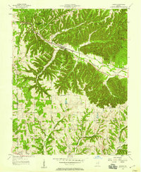 1957 Borden1958 Print · USGSSouthern Indiana in the late fifties shows a landscape of deep hollows and high ridges centered on the MONON rail line. Genealogists can trace rural family roots through landmarks like St Johns Sch, Bear Hill Ch, and the settlement of Starlight.
 - 1957 Map of Livonia, 1958 Print
 1957 Livonia1958 Print · USGSSouthern Indiana's rural landscape at the midpoint of the century reveals a network of small crossroads and community burial grounds. Genealogists can trace family names at Posey Chapel Cem and Sinken Spring Cem or locate the former sites of Lynd Sch and Bromer.
 - 1958 Map of Vincennes
 1958 Vincennes1958 Print · USGSSouthern Indiana and the Illinois borderlands are captured during a mid-century period of heavy rail traffic and military activity. Researchers can trace the sprawling bounds of the Crane Naval Ammunition Depot or locate historic settlements like New Harmony and French Lick.2 unique versions available
 - 1958 Map of Little York, 1959 Print
 1958 Little York1959 Print · USGSWashington and Scott Counties are captured here in the late fifties, showcasing a rural Indiana landscape of ridge-top churches and forested hollows. Researchers can trace family sites at McKnight Cem, visit the settlement of Pumpkin Center, or locate the old Township Sch.6 unique versions available
 - 1958 Map of Tunnelton, 1960 Print
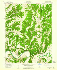 1958 Tunnelton1960 Print · USGSLawrence County at the end of the fifties reveals a landscape shaped by the East Fork White River and the busy Baltimore and Ohio rail line. Genealogists and local historians can trace the foundations of Tunnelton, Fort Ritner, and remote landmarks like Devils Backbone.2 unique versions available
 - 1959 Map of Vallonia, 1960 Print
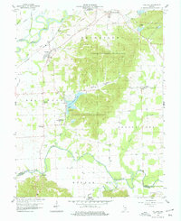 1959 Vallonia1960 Print · USGSJackson County in the late fifties showcases a landscape defined by the winding White and Muscatatuck Rivers. Genealogists can trace family roots through landmarks like Miller Cem, St Pauls Sch, and the historic settlement of Vallonia.4 unique versions available
 - 1959 Map of Medora, 1960 Print
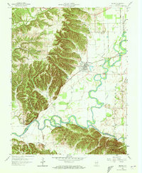 1959 Medora1960 Print · USGSMedora and the surrounding forest lands are documented here during the late fifties, where the railroad and river systems converge. Genealogists and historians can locate family cemeteries like Helm Cemetery, trace the Baltimore and Ohio rail corridor, and find the historic Covered Bridge.4 unique versions available
 - 1959 Map of Tampico, 1960 Print
 1959 Tampico1960 Print · USGSJackson County rural life is captured here in the late fifties, showcasing a landscape of systematic drainage ditches and wooded state forest. Genealogists can locate family landmarks like Lubker Cem, Rucker Cem, and the small settlement of Tampico.3 unique versions available
Showing maps 1-25 of 130
Top cities of Washington County
- Salem historical maps
- New Pekin historical maps
- Campbellsburg historical maps
- Hardinsburg historical maps
- Little York historical maps
- Livonia historical maps
See more
Frequently asked questions
- What are the different types of historical maps available for Washington County?
- What is the oldest map of Washington County?
- Where can I purchase historical maps of Washington County for my home or office?
- Where can I download high-res historical maps of Washington County?
- Are there historical topographic maps available for Washington County?
- Is there historical aerial imagery available for Washington County?
- Where are historical maps of Washington County sourced from?