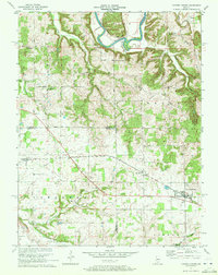
1970 Map of Campbellsburg
USGS Topo · Published 1977About this map
The Monon railroad corridor serves as the primary industrial axis across this southern Indiana landscape, threading together the settlements of Leipsic, Saltillo, and Campbellsburg. To the north, the terrain is defined by the winding course of the East Fork White River, which carves deep meanders like the prominent Horseshoe Bend near the border of Guthrie. This 1970 revision captures a rural area organized by township lines, where small communities like Bono and Stonington anchor a network of country roads.
Find a feature on this map
36 named features on this map. Tap any name to fly to it.
Don’t see what you’re looking for? This feature index may not catch every label — zoom into the map to look around manually.
Map Details
Editions of this 1970 Campbellsburg Map
2 editions found
Other maps of this area

1934 · Bedford
USGS Topo · 1:48,000

1937 · Bedford
USGS Topo · 1:62,500

1950 · Becks Mill
USGS Topo · 1:24,000

1950 · Mitchell
USGS Topo · 1:24,000

1951 · Smedley
USGS Topo · 1:24,000

1956 · Vincennes
USGS Topo · 1:250,000

1957 · Vincennes
USGS Topo · 1:250,000

1957 · Campbellsburg
USGS Topo · 1:24,000

1957 · Livonia
USGS Topo · 1:24,000
1957 · Paoli
USGS Topo · 1:24,000