
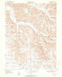
1951 Map of Smedley
USGS Topo · Published 1951About this map
Smedley and the surrounding rural townships of Jefferson and Vernon are documented here just after the mid-century, revealing a landscape defined by sharp ridges and deep hollows. The Chicago Indianapolis and Louisville railroad cuts through the southern terrain, serving the small community of Oxonia (Hitchcock Sta). This geography created a decentralized network of social life, where numerous small congregations and schoolhouses like Prowsville Ch and Four Corners Sch anchored various valleys.
Find a feature on this map
29 named features on this map. Tap any name to fly to it.
Don’t see what you’re looking for? This feature index may not catch every label — zoom into the map to look around manually.
Map Details
Editions of this 1951 Smedley Map
3 editions found
Other maps of this area

1934 · Bedford
USGS Topo · 1:48,000

1937 · Bedford
USGS Topo · 1:62,500

1950 · Salem
USGS Topo · 1:24,000

1950 · Becks Mill
USGS Topo · 1:24,000

1953 · Kossuth
USGS Topo · 1:24,000

1956 · Vincennes
USGS Topo · 1:250,000

1957 · Vincennes
USGS Topo · 1:250,000

1957 · Campbellsburg
USGS Topo · 1:24,000

1957 · Livonia
USGS Topo · 1:24,000

1958 · Vincennes
USGS Topo · 1:250,000