
1958 Map of Vincennes
USGS Topo · Published 1958About this map
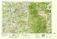
Vincennes and the river-connected landscapes of Southern Indiana and Southeastern Illinois are defined here by a dense network of post-war infrastructure. The sprawling Crane Naval Ammunition Depot stands as a massive military presence in the northeast, while the heavily forested terrain to the south is preserved through the Hoosier National Forest and several state forests, including Ferdinand State Forest and Harrison-Crawford State Forest. This period shows a complex rail system still in heavy use, with the Baltimore and Ohio, Illinois Central, and Louisville and Nashville railroads moving goods across the Wabash River and White River valleys.
Find a feature on this map
96 named features on this map. Tap any name to fly to it.
Don’t see what you’re looking for? This feature index may not catch every label — zoom into the map to look around manually.
Map Details
Editions of this 1958 Vincennes Map
2 editions found
Other maps of this area

1900 · St Meinrad
USGS Topo · 1:62,500

1900 · De Gonia Springs
USGS Topo · 1:62,500

1901 · Owensboro
USGS Topo · 1:62,500

1901 · Princeton
USGS Topo · 1:62,500

1901 · Haubstadt
USGS Topo · 1:62,500

1902 · Ditney
USGS Topo · 1:125,000

1902 · Degonia Springs
USGS Topo · 1:62,500

1902 · Boonville
USGS Topo · 1:62,500

1903 · St. Meinrad
USGS Topo · 1:62,500

1903 · Velpen
USGS Topo · 1:62,500