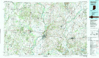
1986 Map of Vincennes
USGS Topo · Published 1989About this map
The Wabash River valley serves as a geographic anchor for this mid-1980s landscape, where the confluence of major waterways and rail corridors shaped the border between Indiana and Illinois. The city of Vincennes is a focal point, noted for Vincennes University and its proximity to the winding White River. The region exhibits a mix of heavy industry and natural preservation, with extensive Strip Mine operations visible near Dugger and Bucktown contrasted against the Greene-Sullivan State Forest.
Find a feature on this map
148 named features on this map. Tap any name to fly to it.
Don’t see what you’re looking for? This feature index may not catch every label — zoom into the map to look around manually.
Map Details
Editions of this 1986 Vincennes Map
2 editions found
Other maps of this area

1901 · Princeton
USGS Topo · 1:62,500

1902 · Ditney
USGS Topo · 1:125,000

1903 · Velpen
USGS Topo · 1:62,500

1903 · Petersburg
USGS Topo · 1:62,500

1903 · Princeton
USGS Topo · 1:62,500

1903 · Patoka
USGS Topo · 1:125,000

1904 · Mount Carmel
USGS Topo · 1:62,500

1908 · Bloomfield
USGS Topo · 1:62,500

1910 · Hardinville
USGS Topo · 1:62,500

1911 · Sumner
USGS Topo · 1:62,500