
Historical Maps of Monroe County, Illinois
What stories do these 144 old maps tell about Monroe County's past? From 1888 to present day, these maps reveal the evolution of streets, neighborhoods, iconic landmarks, and natural features in stunning high-res detail. Whether you're a history enthusiast, genealogist, or professional in education, environmental work, or architecture, these maps are perfect for exploration, research, and discovery.
Discover Monroe County's history through maps:
- Trace Monroe County's growth: Explore earlier and latest maps and editions to uncover how the region changed over time.
- Examine technical details: Each map includes its creators, publishers, scale, dimensions, and full source information.
- Layer maps with modern tools & imagery: Compare historical maps to modern-day with high-resolution satellite imagery and detailed LiDAR layers.
- Sourced from trusted archives: Carefully preserved and digitized by institutions like the United Stated Geological Survey and the US Library of Congress.
- Access in any format: View and explore in high resolution, download for offline use, or order a museum-quality print for yourself or a loved one.
Begin your journey into Monroe County's history with these remarkable must-see maps.
Monroe County, IL maps
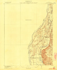
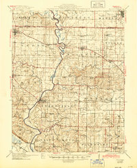
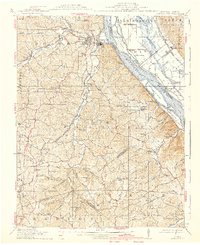
(144)- 1888 Map of St. Louis
 1888 St. Louis1888 Print · USGSCovers Monroe County, including St. Louis, Belleville, and other nearby areas
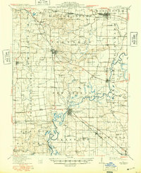
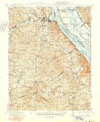
 - 1910 Map of Waterloo, 1956 Print
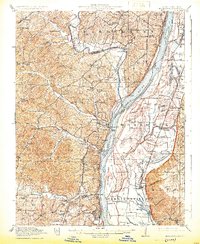
 1910 Waterloo1956 Print · USGSCovers Monroe County, including Belleville, Columbia, and other nearby areas
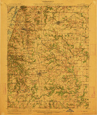
 - 1912 Map of New Athens
 1912 New Athens1912 Print · USGSCovers Monroe County, including Belleville, Mascoutah, and other nearby areas
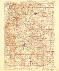
 - 1912 Map of Kimmswick
 1912 Kimmswick1912 Print · USGSCovers Monroe County, including Oakville, Arnold, and other nearby areas
 - 1912 Map of Kimmswick
 1912 Kimmswick1912 Print · USGSCovers Monroe County, including Oakville, Arnold, and other nearby areas
 - 1912 Map of New Athens, 1948 Print
 1912 New Athens1948 Print · USGSCovers Monroe County, including Belleville, Mascoutah, and other nearby areas
 - 1912 Map of Baldwin, 1967 Print
 1912 Baldwin1967 Print · USGSCovers Monroe County, including Sparta, Red Bud, and other nearby areas
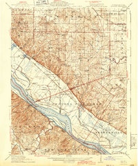
 - 1913 Map of Waterloo
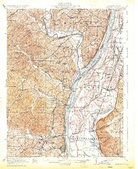
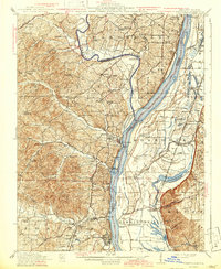
 1913 Waterloo1913 Print · USGSCovers Monroe County, including Belleville, Columbia, and other nearby areas
 - 1913 Map of Waterloo
 1913 Waterloo1913 Print · USGSCovers Monroe County, including Belleville, Columbia, and other nearby areas
 - 1913 Map of Waterloo, 1941 Print
 1913 Waterloo1941 Print · USGSCovers Monroe County, including Belleville, Columbia, and other nearby areas
 - 1914 Map of Baldwin
 1914 Baldwin1914 Print · USGSCovers Monroe County, including Sparta, Red Bud, and other nearby areas
 - 1914 Map of Baldwin, 1944 Print
 1914 Baldwin1944 Print · USGSCovers Monroe County, including Sparta, Red Bud, and other nearby areas
 - 1915 Map of Renault
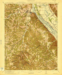
 1915 Renault1915 Print · USGSCovers Monroe County, including Sainte Genevieve, Red Bud, and other nearby areas
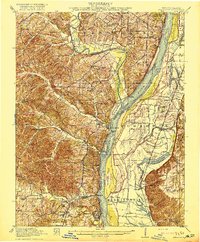
 - 1915 Map of Crystal City
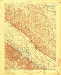
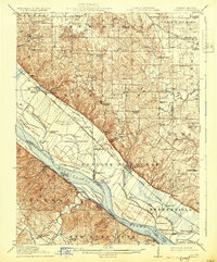
 1915 Crystal City1915 Print · USGSCovers Monroe County, including Festus, Crystal City, and other nearby areas
 - 1915 Map of Crystal City
 1915 Crystal City1915 Print · USGSCovers Monroe County, including Festus, Crystal City, and other nearby areas
 - 1915 Map of Renault
 1915 Renault1915 Print · USGSCovers Monroe County, including Sainte Genevieve, Red Bud, and other nearby areas
 - 1915 Map of Renault, 1931 Print
 1915 Renault1931 Print · USGSCovers Monroe County, including Sainte Genevieve, Red Bud, and other nearby areas
 - 1915 Map of Crystal City, 1939 Print
 1915 Crystal City1939 Print · USGSCovers Monroe County, including Festus, Crystal City, and other nearby areas
 - 1915 Map of Renault, 1943 Print
 1915 Renault1943 Print · USGSCovers Monroe County, including Sainte Genevieve, Red Bud, and other nearby areas
 - 1915 Map of Crystal City, 1950 Print
 1915 Crystal City1950 Print · USGSCovers Monroe County, including Festus, Crystal City, and other nearby areas
 - 1916 Map of Kimmswick
 1916 Kimmswick1916 Print · USGSCovers Monroe County, including Oakville, Arnold, and other nearby areas
 - 1916 Map of Kimmswick
 1916 Kimmswick1916 Print · USGSCovers Monroe County, including Oakville, Arnold, and other nearby areas
 - 1916 Map of Kimmswick, 1925 Print
 1916 Kimmswick1925 Print · USGSCovers Monroe County, including Oakville, Arnold, and other nearby areas
 - 1916 Map of Kimmswick, 1933 Print
 1916 Kimmswick1933 Print · USGSCovers Monroe County, including Oakville, Arnold, and other nearby areas
 - 1916 Map of Kimmswick, 1942 Print
 1916 Kimmswick1942 Print · USGSCovers Monroe County, including Oakville, Arnold, and other nearby areas
Showing maps 1-25 of 144
Top cities in Monroe County
- Columbia historical maps
- Waterloo historical maps
- Valmeyer historical maps
- Maeystown historical maps
- Fults historical maps
Frequently asked questions
- What are the different types of historical maps available for Monroe County?
- What is the oldest map of Monroe County?
- Where can I purchase historical maps of Monroe County for my home or office?
- Where can I download high-res historical maps of Monroe County?
- Are there historical topographic maps available for Monroe County?
- Is there historical aerial imagery available for Monroe County?
- Where are historical maps of Monroe County sourced from?