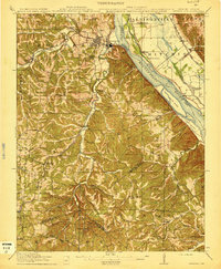
1915 Map of Crystal City
USGS Topo · Published 1915About this map
Crystal City and Festus stand as the primary industrial and population centers along the Joachim Creek corridor during this 1915 survey. The map details a landscape defined by its extractive industries and complex transportation network, featuring several major rail lines including the St Louis Iron Mountain and Southern RR and the St Louis San Francisco RR. To the south, Valles Mines serves as a reminder of the region's lead mining heritage, while rural life is marked by a dense distribution of one-room schoolhouses like Telegraph School and Saltpeter School. The Mississippi River corridor is particularly intricate here, showing substantial river islands such as Harlow Island and Calico Island alongside active riverboat points like Kemper Ldg. This period illustrates the peak of the local rail-and-river economy before the widespread expansion of modern highways changed the rural character of Jefferson County.
Find a feature on this map
70 named features on this map. Tap any name to fly to it.
Don’t see what you’re looking for? This feature index may not catch every label — zoom into the map to look around manually.
Map Details
Editions of this 1915 Crystal City Map
4 editions found

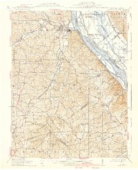
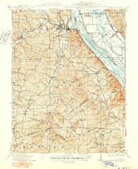
Other maps of this area

1901 · De Soto
USGS Topo · 1:125,000

1904 · Farmington
USGS Topo · 1:62,500

1905 · Bonneterre
USGS Topo · 1:62,500

1906 · Farmington
USGS Topo · 1:62,500

1907 · Weingarten
USGS Topo · 1:62,500

1909 · Weingarten
USGS Topo · 1:62,500

1910 · Waterloo
USGS Topo · 1:62,500

1912 · Kimmswick
USGS Topo · 1:62,500

1913 · Waterloo
USGS Topo · 1:62,500

1915 · Renault
USGS Topo · 1:62,500