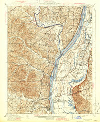
1916 Map of Kimmswick
USGS Topo · Published 1942About this map
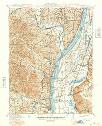
Jefferson Barracks occupies the high ground overlooking the Mississippi River in this survey of the river valley and its surrounding highlands. This document highlights a critical transport corridor during the early 1940s, where the St Louis Iron Mountain and Southern railroad tracks hug the western riverbank, connecting river towns like Kimmswick, Sulphur Springs, and Herculaneum. Across the water in Illinois, the low-lying agricultural landscape of Mordock and Harrisonville is punctuated by Moredock Lake and numerous drainage slashes, contrasting sharply with the rugged, creek-carved bluffs of the Missouri side.
Find a feature on this map
86 named features on this map. Tap any name to fly to it.
Don’t see what you’re looking for? This feature index may not catch every label — zoom into the map to look around manually.
Map Details
Editions of this 1916 Kimmswick Map
6 editions found
Other maps of this area

1888 · St. Louis
USGS Topo · 1:62,500

1901 · De Soto
USGS Topo · 1:125,000

1903 · O'Fallon
USGS Topo · 1:125,000

1910 · Waterloo
USGS Topo · 1:62,500

1912 · Kimmswick
USGS Topo · 1:62,500

1913 · Waterloo
USGS Topo · 1:62,500

1915 · Renault
USGS Topo · 1:62,500

1915 · Crystal City
USGS Topo · 1:62,500

1916 · Kimmswick
USGS Topo · 1:62,500

1930 · De Soto NE
USGS Topo · 1:24,000