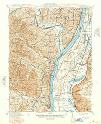
1916 Map of Kimmswick
USGS Topo · Published 1948About this map
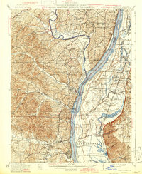
Jefferson Barracks anchors the northern boundary of this river landscape, which traces the transition from the Meramec River to the sweeping bend of the Mississippi River. The region reflects a deeply interconnected river-and-rail economy at mid-century, where the St Louis San Francisco and Missouri Pacific railroads parallel the water, serving industrial and agricultural hubs like Herculaneum and Kimmswick. A dense network of one-room schoolhouses, such as Bowles School, Antonia School, and Miles Prairie School, reveals the established rural communities spread across the hills and floodplains.
Find a feature on this map
101 named features on this map. Tap any name to fly to it.
Don’t see what you’re looking for? This feature index may not catch every label — zoom into the map to look around manually.
Map Details
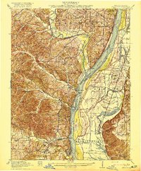
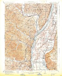
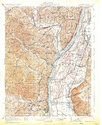
Editions of this 1916 Kimmswick Map
6 editions found
Other maps of this area

1888 · St. Louis
USGS Topo · 1:62,500

1901 · De Soto
USGS Topo · 1:125,000

1903 · O'Fallon
USGS Topo · 1:125,000

1910 · Waterloo
USGS Topo · 1:62,500

1912 · Kimmswick
USGS Topo · 1:62,500

1913 · Waterloo
USGS Topo · 1:62,500

1915 · Renault
USGS Topo · 1:62,500

1915 · Crystal City
USGS Topo · 1:62,500

1916 · Kimmswick
USGS Topo · 1:62,500

1930 · De Soto NE
USGS Topo · 1:24,000