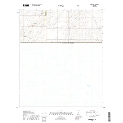
2018 Map of Campini Mesa
USGS Topo · Published 2018About this map
Coronado National Forest lands dominate the northern landscape of this borderlands region, where the high terrain of Campini Mesa provides a prominent natural landmark. The map illustrates a complex network of drainages and canyons, including Blacktail Canyon and Bodie Canyon in the northwest, which transition toward the international boundary. This 2018 survey captures the intersection of Santa Cruz and Cochise counties just north of the United States and Mexico border. The rugged topography is further detailed through named features like Sunnyside Canyon and the seasonal flow of Joaquin Creek. This area remains largely defined by its natural relief and jurisdictional boundaries rather than permanent settlements, reflecting the remote character of the southern Arizona mountains.
Find a feature on this map
10 named features on this map. Tap any name to fly to it.
Don’t see what you’re looking for? This feature index may not catch every label — zoom into the map to look around manually.
Map Details
Editions of this 2018 Campini Mesa Map
This is the sole edition of this map. No revisions or reprints were ever made.
Other maps of this area

1905 · Nogales
USGS Topo · 1:125,000

1914 · Hereford
USGS Topo · 1:125,000

1922 · Sunnyside
USGS Topo · 1:62,500

1932 · Lochiel
USGS Topo · 1:62,500

1938 · Sunnyside
USGS Topo · 1:62,500

1948 · Canelo Pass
USGS Topo · 1:24,000

1948 · Huachuca Peak
USGS Topo · 1:24,000

1948 · Miller Peak
USGS Topo · 1:24,000

1948 · Sunnyside SE
USGS Topo · 1:24,000
1948 · Sunnyside SW
USGS Topo · 1:24,000