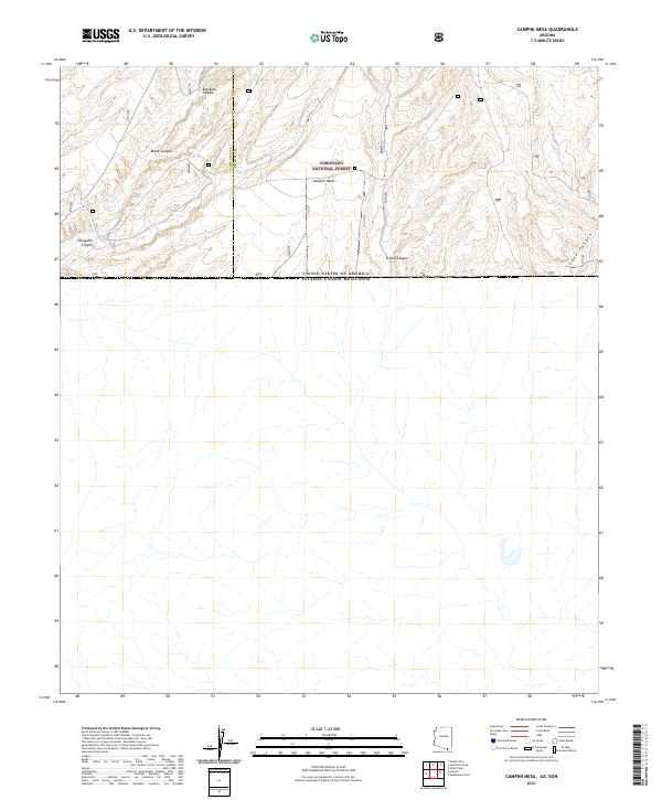
2021 Map of Campini Mesa
USGS Topo · Published 2021About this map
Coronado National Forest lands dominate this high-desert landscape along the international boundary, where the southern reaches of the Huachuca Mountains meet the border. The terrain is defined by a series of prominent drainages including Sunnyside Canyon, Bodie Canyon, and Blacktail Canyon, which carve through the high elevations. Central to the sheet is Campini Mesa, a significant topographic feature situated between the Santa Cruz and Cochise county lines. The map also records Joaquin Cr and School Canyon, illustrating the drainage patterns of this border region. This survey captures the topographical isolation of the area as it appeared in the early 21st century, showing the intersection of federal forest land and the United States - Mexico border.
Find a feature on this map
12 named features on this map. Tap any name to fly to it.
Don’t see what you’re looking for? This feature index may not catch every label — zoom into the map to look around manually.
Map Details
Editions of this 2021 Campini Mesa Map
This is the sole edition of this map. No revisions or reprints were ever made.
Other maps of this area

1905 · Nogales
USGS Topo · 1:125,000

1914 · Hereford
USGS Topo · 1:125,000

1922 · Sunnyside
USGS Topo · 1:62,500

1932 · Lochiel
USGS Topo · 1:62,500

1938 · Sunnyside
USGS Topo · 1:62,500

1948 · Canelo Pass
USGS Topo · 1:24,000

1948 · Huachuca Peak
USGS Topo · 1:24,000

1948 · Miller Peak
USGS Topo · 1:24,000

1948 · Sunnyside SE
USGS Topo · 1:24,000
1948 · Sunnyside SW
USGS Topo · 1:24,000