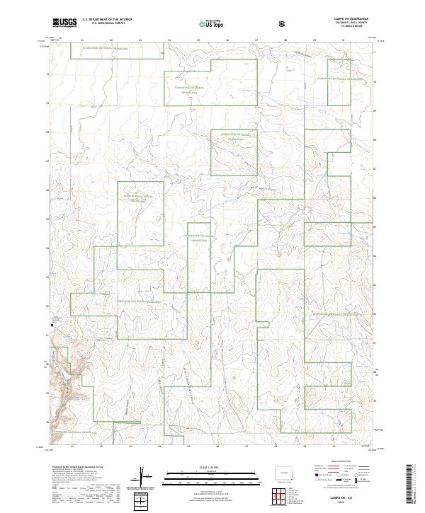
2023 Map of Campo SW
USGS Topo · Published 2023About this map
Comanche National Grassland dominates this corner of Baca County, where the landscape is defined by a series of deep drainages cutting through the high plains. The terrain is marked by significant topographical relief, including the prominent Picture Canyon and West Pawnee Trail Canyon in the southern portion of the map. These features suggest a landscape where water and wind have carved distinct paths over time, providing natural landmarks in an otherwise open prairie environment. Genealogy and local history researchers can identify the Chadderdon Capansky Cem, a small site situated near Co RD 19 in the southwest. A network of county roads, such as Co RD J and Co RD 25, provides access through the public lands and across the various canyons like Red Canyon and North Ute Canyon.
Find a feature on this map
24 named features on this map. Tap any name to fly to it.
Don’t see what you’re looking for? This feature index may not catch every label — zoom into the map to look around manually.
Map Details
Editions of this 2023 Campo SW Map
This is the sole edition of this map. No revisions or reprints were ever made.
Other maps of this area

1891 · Springfield
USGS Topo · 1:125,000

1893 · Springfield
USGS Topo · 1:125,000

1954 · Dalhart
USGS Topo · 1:250,000

1955 · La Junta
USGS Topo · 1:250,000

1958 · La Junta
USGS Topo · 1:250,000

1958 · Dalhart
USGS Topo · 1:250,000

1962 · Dalhart
USGS Topo · 1:250,000

1968 · La Junta
USGS Topo · 1:250,000

1968 · Autograph Cliff NW
USGS Topo · 1:24,000
1969 · Kenton NE
USGS Topo · 1:24,000