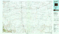
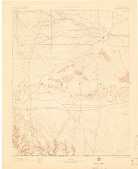
1893 Map of Springfield
USGS Topo · Published 1893About this map
Springfield stands as the primary settlement on this late nineteenth-century survey, situated at the edge of a landscape defined by dramatic arroyos and intermittent waterways. Surveyed in 1890, the map illustrates the early development of Baca County, before the widespread agricultural transformation of the High Plains. The terrain is marked by the branching paths of Bear Creek and Cat Creek, which give way to the more desert-like formations of Sand Arroyo and the deep incisions of Red Cañon and Pit Cañon in the southwest. A notable historical feature is the southern edge of the map, which clearly delineates the Colorado Oklahoma Boundary Line, marking the limit of the state against the Public Land Strip (the Oklahoma Panhandle) just a few years after that territory was officially organized. The distribution of wagon roads connecting the central town to remote canyons reflects a frontier economy reliant on ranching and the natural drainage patterns of the southern plains.
Find a feature on this map
11 named features on this map. Tap any name to fly to it.
Don’t see what you’re looking for? This feature index may not catch every label — zoom into the map to look around manually.
Map Details
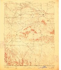
Editions of this 1893 Springfield Map
4 editions found
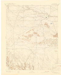
Historical Maps of Springfield Through Time
3 maps found