1893 Map of Springfield
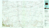
USGS Topo · Published 1943About this map
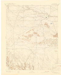
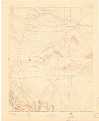
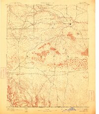
Springfield sits at the junction of early roads and watercourses in the high plains of southeastern Colorado. This reconnaissance survey, conducted by R.B. Marshall and T. E. Grafton, documents the drainage systems of the region before the arrival of modern irrigation and heavy development. The landscape is defined by its intermittent and seasonal water features, including the winding course of Bear Creek to the north and Cat Creek closer to the central settlement. Multiple branches of Sand Arroyo cut through the sandy, elevated terrain, illustrating the natural erosion patterns of the arid High Plains. The map provides a look at the foundational transport network of the county, showing a web of early trails and wagon roads that radiated from the fledgling county seat into the surrounding prairie long before the modern highway system was established.
Find a feature on this map
6 named features on this map. Tap any name to fly to it.
Don’t see what you’re looking for? This feature index may not catch every label — zoom into the map to look around manually.
Map Details
Editions of this 1893 Springfield Map
4 editions found

Historical Maps of Springfield Through Time
3 maps found