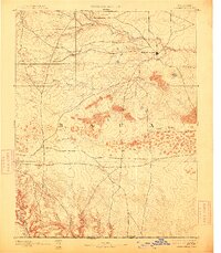
1893 Map of Springfield
USGS Topo · Published 1913About this map
Springfield sits as the central node of this high plains landscape, surveyed shortly after Colorado statehood in the 1890s. The topography is defined by the sharp transition from the open northern plateaus to the deeply incised drainage systems of the south. Water courses like Bear Creek, Cat Creek, and the extensive Sand Arroyo network across the central territory, eventually giving way to a series of dramatic canyon formations. These geological features, including Pat Cañon and Gallinas Cañon, illustrate the natural erosion patterns leading toward the Colorado Oklahoma Boundary Line. The presence of roads radiating from the settlement suggests its role as a nascent regional hub, while the surveyor's notation of sandy terrain reveals the environmental challenges faced by early settlers in Baca County during this era of western expansion.
Find a feature on this map
11 named features on this map. Tap any name to fly to it.
Don’t see what you’re looking for? This feature index may not catch every label — zoom into the map to look around manually.
Map Details
Editions of this 1893 Springfield Map
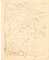
4 editions found
Other maps of this area

1891 · Albany
USGS Topo · 1:125,000

1891 · Higbee
USGS Topo · 1:125,000

1891 · Springfield
USGS Topo · 1:125,000

1892 · Vilas
USGS Topo · 1:125,000

1892 · Two Butte
USGS Topo · 1:125,000

1892 · Mt Carrizo
USGS Topo · 1:125,000

1893 · Higbee
USGS Topo · 1:125,000

1893 · Two Butte
USGS Topo · 1:125,000

1893 · Springfield
USGS Topo · 1:125,000

1893 · Albany
USGS Topo · 1:125,000