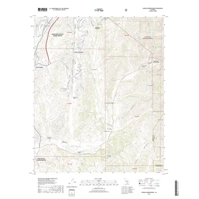
2018 Map of Canada Gobernadora
USGS Topo · Published 2018About this map
Coto De Caza and its sophisticated street network define the northern landscape of this region, characterized by deep canyons and the sprawling expanse of the Cleveland National Forest. The map documents a complex transition from high-density residential planning in Trabuco Highlands and Dove Canyon to the preserved wilderness of Hot Spring Canyon. In the east, San Juan Hot Springs remains a distinctive landmark where the terrain drops sharply toward the water. The lower reaches of the map follow the broad drainage of San Juan Creek as it passes toward the edge of San Juan Capistrano. This survey captures the precise footprint of late-2010s suburban development as it meets the natural barriers of Cañada Gobernadora and the steep ridges of Wagon-Wheel Canyon.
Find a feature on this map
80 named features on this map. Tap any name to fly to it.
Don’t see what you’re looking for? This feature index may not catch every label — zoom into the map to look around manually.
Map Details
Editions of this 2018 Canada Gobernadora Map
This is the sole edition of this map. No revisions or reprints were ever made.
Other maps of this area

1901 · Southern California Sheet No. 1
USGS Topo · 1:250,000

1901 · Elsinore
USGS Topo · 1:125,000

1901 · San Luis Rey
USGS Topo · 1:125,000

1902 · Capistrano
USGS Topo · 1:125,000

1902 · Corona
USGS Topo · 1:125,000

1904 · Southern California Sheet No. 2
USGS Topo · 1:250,000

1904 · Southern California Sheet No. 1
USGS Topo · 1:250,000

1906 · Capistrano
USGS Topo · 1:125,000

1935 · El Toro
USGS Topo · 1:31,680

1941 · Margarita Peak
USGS Topo · 1:62,500
Featured Places
- Rancho Santa Margarita, CA
- San Juan Capistrano, CA
- Coto De Caza, Coto de Caza
- San Juan Hot Springs, CA
- Trabuco Highlands, Rancho Santa Margarita