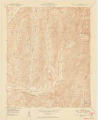
1949 Map of Canada Gobernadora
USGS Topo · Published 1949About this map
Mission Viejo and the surrounding ranch lands of southern Orange County are captured here just before the era of intensive suburban development. The landscape is defined by a dense network of seasonal drainages, including Arroyo Trabuco and Cañada Gobernadora, which converge toward the San Juan Creek valley. A notable archaeological and historical marker is the Old Mission Site located along the north bank of the creek, providing a clear reference point for the region’s early colonial roots.
Find a feature on this map
26 named features on this map. Tap any name to fly to it.
Don’t see what you’re looking for? This feature index may not catch every label — zoom into the map to look around manually.
Map Details
Editions of this 1949 Canada Gobernadora Map
2 editions found
Other maps of this area

1901 · Southern California Sheet No. 1
USGS Topo · 1:250,000

1901 · Elsinore
USGS Topo · 1:125,000

1901 · San Luis Rey
USGS Topo · 1:125,000

1902 · Capistrano
USGS Topo · 1:125,000

1902 · Corona
USGS Topo · 1:125,000

1904 · Southern California Sheet No. 2
USGS Topo · 1:250,000

1904 · Southern California Sheet No. 1
USGS Topo · 1:250,000

1906 · Capistrano
USGS Topo · 1:125,000

1935 · El Toro
USGS Topo · 1:31,680

1941 · Margarita Peak
USGS Topo · 1:62,500