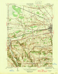
1946 Map of Canastota
USGS Topo · Published 1946About this map
The transit corridor of Canastota and Chittenango dominates this mid-century survey, revealing a landscape shaped by water and rail. The northern reaches show a complex drainage network involving the Old Erie Canal, the West Shore Canal, and the Barge Canal Feeder, while the New York Central (4 Tracks) provides a heavy-duty industrial spine for the region. These engineering feats contrast with the rugged southern elevations of Lincoln and Fenner, where local life is anchored by rural landmarks like the Cottons Sch and the Oak Hill Sch.
Find a feature on this map
50 named features on this map. Tap any name to fly to it.
Don’t see what you’re looking for? This feature index may not catch every label — zoom into the map to look around manually.
Map Details
Editions of this 1946 Canastota Map
2 editions found
Other maps of this area

1895 · Chittenango
USGS Topo · 1:62,500

1895 · Oneida
USGS Topo · 1:62,500

1897 · Cazenovia
USGS Topo · 1:62,500

1898 · Oneida
USGS Topo · 1:62,500

1898 · Chittenango
USGS Topo · 1:62,500

1899 · Cazenovia
USGS Topo · 1:62,500

1902 · Chittenango
USGS Topo · 1:62,500

1902 · Morrisville
USGS Topo · 1:62,500

1902 · Oneida
USGS Topo · 1:62,500

1939 · Oneida
USGS Topo · 1:62,500