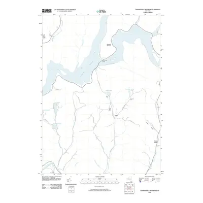
2010 Map of Cannonsville Reservoir
USGS Topo · Published 2010About this map
Cannonsville Reservoir dominates the landscape of this Delaware County region, representing a significant mid-century hydrological transformation of the upper Delaware River system. The massive reservoir is crossed by the Cannonsville Bridge and framed by high elevations such as Speedwell Mountain. To the south, the settlement of Kelsey serves as a local hub near the recreational waters of Russell Lake and Hathaway Pond.
Find a feature on this map
43 named features on this map. Tap any name to fly to it.
Don’t see what you’re looking for? This feature index may not catch every label — zoom into the map to look around manually.
Map Details
Editions of this 2010 Cannonsville Reservoir Map
This is the sole edition of this map. No revisions or reprints were ever made.
Other maps of this area

1920 · Long Eddy
USGS Topo · 1:62,500

1921 · Long Eddy
USGS Topo · 1:48,000

1923 · Long Eddy
USGS Topo · 1:62,500

1923 · Walton
USGS Topo · 1:48,000

1924 · Starrucca
USGS Topo · 1:48,000

1924 · Deposit
USGS Topo · 1:62,500

1925 · Walton
USGS Topo · 1:62,500

1926 · Deposit
USGS Topo · 1:62,500

1926 · Starrucca
USGS Topo · 1:62,500

1930 · Starrucca
USGS Topo · 1:48,000