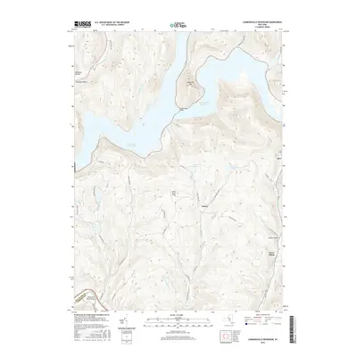
2016 Map of Cannonsville Reservoir
USGS Topo · Published 2016About this map
Cannonsville Reservoir dominates the northern landscape of this Delaware County survey, where the flooded valley of the West Branch Delaware River has reshaped the local geography. The massive impoundment is crossed by the Cannonsville Bridge and fed by numerous steep-gradient tributaries such as Johnny Brook and Chamberlain Brook. To the south, the terrain transitions into a complex system of ridges and hollows, including Michigan Hollow and the notable Delaware River Gorge at the southwestern boundary. Small settlements and former rail stops like Kerry Siding and Apex dot the periphery of the highlands. The presence of several upland water bodies, including Russell Lake and Hathaway Pond, alongside the winding course of Sands Creek, illustrates the hydrological richness of this Catskill region watershed during the early 21st century.
Find a feature on this map
45 named features on this map. Tap any name to fly to it.
Don’t see what you’re looking for? This feature index may not catch every label — zoom into the map to look around manually.
Map Details
Editions of this 2016 Cannonsville Reservoir Map
This is the sole edition of this map. No revisions or reprints were ever made.
Other maps of this area

1920 · Long Eddy
USGS Topo · 1:62,500

1921 · Long Eddy
USGS Topo · 1:48,000

1923 · Long Eddy
USGS Topo · 1:62,500

1923 · Walton
USGS Topo · 1:48,000

1924 · Starrucca
USGS Topo · 1:48,000

1924 · Deposit
USGS Topo · 1:62,500

1925 · Walton
USGS Topo · 1:62,500

1926 · Deposit
USGS Topo · 1:62,500

1926 · Starrucca
USGS Topo · 1:62,500

1930 · Starrucca
USGS Topo · 1:48,000