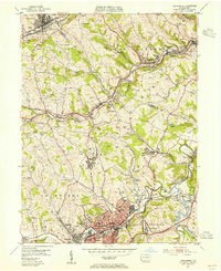
1953 Map of Canonsburg
USGS Topo · Published 1955About this map
Industrial Washington County activity is evident in this early 1950s survey, where the coal and oil industries have left a distinct mark on the landscape. Numerous oil and gas wells dot the hillsides of Cecil and South Fayette, while extensive mine dump areas surround operations like National No 3 Mine and Lodie Mine. The region is crisscrossed by a dense rail network, including the Pittsburgh and West Virginia RR and the Pennsylvania RR, which served the active mining and manufacturing sectors in Canonsburg and Strabane.
Find a feature on this map
96 named features on this map. Tap any name to fly to it.
Don’t see what you’re looking for? This feature index may not catch every label — zoom into the map to look around manually.
Map Details
Editions of this 1953 Canonsburg Map
This is the sole edition of this map. No revisions or reprints were ever made.
Other maps of this area

1901 · Amity
USGS Topo · 1:62,500

1904 · Amity
USGS Topo · 1:62,500

1904 · Carnegie
USGS Topo · 1:62,500

1904 · Burgettstown
USGS Topo · 1:62,500

1906 · Burgettstown
USGS Topo · 1:62,500

1906 · Carnegie
USGS Topo · 1:62,500

1907 · Claysville
USGS Topo · 1:62,500

1908 · Carnegie
USGS Topo · 1:62,500

1948 · Pittsburgh West
USGS Topo · 1:24,000
1951 · Pittsburgh West
USGS Topo · 1:24,000