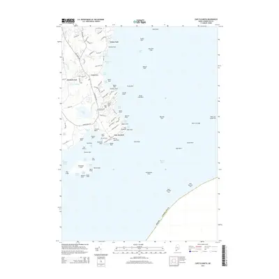
2014 Map of Cape Elizabeth
USGS Topo · Published 2014About this map
Cape Elizabeth defines this stretch of the Maine coastline, where the land fragmentizes into numerous rocky points and coves south of Casco Bay. Residential enclaves such as Delano Park, Shore Acres, and Elizabeth Park are established along the interior roads, while the shoreline is a complex network of maritime hazards and small harbors including Richmond Island Harbor and Pond Cove. The landscape is a mix of wooded rises like Blue Hill and significant freshwater features such as Great Pond and Richards Pond. Geodetic markers and local history intersect at the Cape Elizabeth Church Cem, while the southern reaches show the tidal influence of the Spurwink River. Off the coast, the map details an extensive array of named ledges and reefs, from Trundy Reef to West Cod Ledge, indicating the area's long-standing relationship with the Atlantic.
Find a feature on this map
108 named features on this map. Tap any name to fly to it.
Don’t see what you’re looking for? This feature index may not catch every label — zoom into the map to look around manually.
Map Details
Editions of this 2014 Cape Elizabeth Map
This is the sole edition of this map. No revisions or reprints were ever made.
Other maps of this area

1891 · Portland
USGS Topo · 1:62,500

1891 · Biddeford
USGS Topo · 1:62,500

1893 · Biddeford
USGS Topo · 1:62,500

1893 · Portland
USGS Topo · 1:62,500

1893 · Casco Bay
USGS Topo · 1:62,500

1914 · Portland
USGS Topo · 1:48,000

1914 · Casco Bay
USGS Topo · 1:48,000

1916 · Portland
USGS Topo · 1:62,500

1916 · Casco Bay
USGS Topo · 1:62,500

1916 · Portland And Vicinity
USGS Topo · 1:62,500