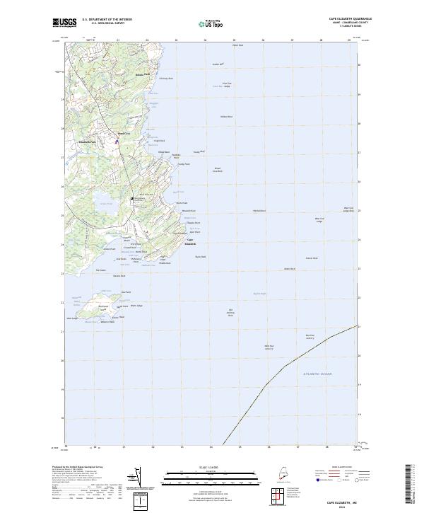
2024 Map of Cape Elizabeth
USGS Topo · Published 2024About this map
Cape Elizabeth is defined by its intricate shoreline and maritime character, where the rocky Atlantic coast meets established residential neighborhoods and conservation land. Residential pockets such as Delano Park and Shore Acres Hill are woven between numerous small inlets like Pond Cove and Smugglers Cove, illustrating the peninsula's longstanding appeal as a coastal community. The landscape is punctuated by a mix of interior freshwater features, including Great Pond and Little Pond, which sit just inland from the saltwater spray of Casco Bay.
Find a feature on this map
109 named features on this map. Tap any name to fly to it.
Don’t see what you’re looking for? This feature index may not catch every label — zoom into the map to look around manually.
Map Details
Editions of this 2024 Cape Elizabeth Map
This is the sole edition of this map. No revisions or reprints were ever made.
Other maps of this area

1891 · Portland
USGS Topo · 1:62,500

1891 · Biddeford
USGS Topo · 1:62,500

1893 · Biddeford
USGS Topo · 1:62,500

1893 · Portland
USGS Topo · 1:62,500

1893 · Casco Bay
USGS Topo · 1:62,500

1914 · Portland
USGS Topo · 1:48,000

1914 · Casco Bay
USGS Topo · 1:48,000

1916 · Portland
USGS Topo · 1:62,500

1916 · Casco Bay
USGS Topo · 1:62,500

1916 · Portland And Vicinity
USGS Topo · 1:62,500