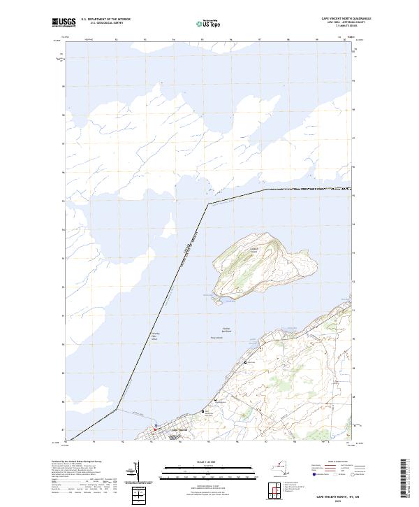
2023 Map of Cape Vincent North
USGS Topo · Published 2023About this map
The Saint Lawrence River serves as the international boundary on this sheet, separating the town of Cape Vincent from Canada. Central to the map is Carleton Island, a prominent landmass defined by its indented shoreline including North Bay and South Bay. The navigation of the river is marked by numerous hazards and geographical features such as Hinckley Flats Shoal and Feather Bed Shoal, while Horne's Ferry indicates a traditional water crossing point at the river's edge.
Find a feature on this map
23 named features on this map. Tap any name to fly to it.
Don’t see what you’re looking for? This feature index may not catch every label — zoom into the map to look around manually.
Map Details
Editions of this 2023 Cape Vincent North Map
This is the sole edition of this map. No revisions or reprints were ever made.
Other maps of this area

1895 · Cape Vincent
USGS Topo · 1:62,500

1900 · Clayton
USGS Topo · 1:62,500

1903 · Grindstone
USGS Topo · 1:62,500

1903 · Clayton
USGS Topo · 1:62,500

1942 · Cape Vincent North
USGS Topo · 1:31,680

1942 · Chaumont
USGS Topo · 1:31,680

1942 · Sawmill Bay
USGS Topo · 1:31,680

1942 · Cape Vincent South
USGS Topo · 1:31,680
1943 · Grindstone
USGS Topo · 1:31,680
1944 · Cape Vincent
USGS Topo · 1:62,500