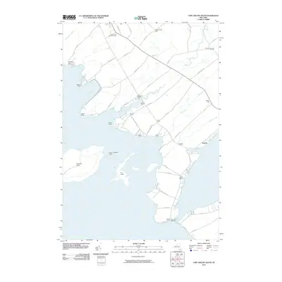
2010 Map of Cape Vincent South
USGS Topo · Published 2010About this map
Tibbetts Point and the Cape Vincent Breakwater Light stand as navigational markers where the Saint Lawrence River begins its journey from Lake Ontario. This coastal landscape is defined by its deep indents and islands, from the wide expanse of Wilson Bay to the protected reaches of Mud Bay. The map reveals a high concentration of nautical infrastructure along the eastern shore, including Snug Harbor Marina, Martins Marina, and Brimmers Marina near The Isthmus. Inland, the settlement pattern clusters around rural junctions like Bedford Corners and Ponds Corners, connected by a network of county roads. Genealogists can locate legacy sites such as the Saint Vincent de Paul Cemetery and Fox Creek Cemetery, while the presence of Grenadier Island and Fox Island offshore highlights the region's complex archipelago geography.
Find a feature on this map
63 named features on this map. Tap any name to fly to it.
Don’t see what you’re looking for? This feature index may not catch every label — zoom into the map to look around manually.
Map Details
Editions of this 2010 Cape Vincent South Map
This is the sole edition of this map. No revisions or reprints were ever made.
Other maps of this area

1893 · Sackets Harbor
USGS Topo · 1:62,500

1895 · Sacketts Harbor
USGS Topo · 1:62,500

1895 · Stony Island
USGS Topo · 1:62,500

1895 · Cape Vincent
USGS Topo · 1:62,500

1900 · Clayton
USGS Topo · 1:62,500

1903 · Clayton
USGS Topo · 1:62,500

1942 · Cape Vincent North
USGS Topo · 1:31,680

1942 · Henderson Bay
USGS Topo · 1:31,680

1942 · Chaumont
USGS Topo · 1:31,680

1942 · Galloo Island
USGS Topo · 1:31,680