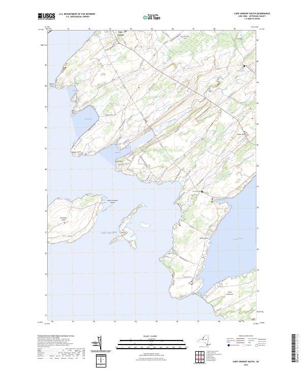
2023 Map of Cape Vincent South
USGS Topo · Published 2023About this map
Lake Ontario defines this corner of Jefferson County, where the St. Lawrence River begins its journey. The coastline is deeply indented by bays such as Wilson Bay and Mud Bay, separated by prominent landforms like Tibbetts Point and Dablon Point. Just offshore, Grenadier Island and Little Grenadier Island guard the entrance to Basin Harbor, reflecting the area's long maritime importance. Inland, the landscape transitions from the agricultural fields near Indian Hill to the complex wetlands surrounding Fox Creek and Kents Creek. Historic sites and local landmarks are scattered throughout the region, including Saint Vincent de Paul Cem near the town of Cape Vincent and Fox Creek Cem further south. Narrow land bridges like Carrying Place and The Isthmus connect the mainland to Point Peninsula, illustrating the unique geography that has shaped local transport and settlement patterns for generations.
Find a feature on this map
71 named features on this map. Tap any name to fly to it.
Don’t see what you’re looking for? This feature index may not catch every label — zoom into the map to look around manually.
Map Details
Editions of this 2023 Cape Vincent South Map
This is the sole edition of this map. No revisions or reprints were ever made.
Other maps of this area

1893 · Sackets Harbor
USGS Topo · 1:62,500

1895 · Sacketts Harbor
USGS Topo · 1:62,500

1895 · Stony Island
USGS Topo · 1:62,500

1895 · Cape Vincent
USGS Topo · 1:62,500

1900 · Clayton
USGS Topo · 1:62,500

1903 · Clayton
USGS Topo · 1:62,500

1942 · Cape Vincent North
USGS Topo · 1:31,680

1942 · Henderson Bay
USGS Topo · 1:31,680

1942 · Chaumont
USGS Topo · 1:31,680

1942 · Galloo Island
USGS Topo · 1:31,680