
1950 Map of Cape Vizcaino
USGS Topo · Published 1960About this map
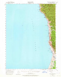
Rockport and the northern Mendocino coast appear here during the mid-century transition from early maritime commerce to an economy heavily reliant on timber extraction. This 1950 field-checked survey highlights a series of small, isolated coastal landings and settlements including Hardy, Westport, and Kibesillah. The infrastructure of the era is clearly marked by the prominent Logging Road network tracking the Tenmile River, illustrating how the industry moved deep into the inland ridges such as Cottoneva Ridge and Lincoln Ridge. Evidence of established community life is visible at the Ft Bragg Grange and several small Cem locations. The coastline itself is defined by numerous maritime landmarks like Cape Vizcaino and Abalone Point, which once served as vital navigation aids for the coastal shipping that supported these remote outposts.
Find a feature on this map
50 named features on this map. Tap any name to fly to it.
Don’t see what you’re looking for? This feature index may not catch every label — zoom into the map to look around manually.
Map Details
Editions of this 1950 Cape Vizcaino Map
2 editions found
Other maps of this area

1920 · Glenblair
USGS Topo · 1:62,500

1920 · Cummings
USGS Topo · 1:62,500

1920 · Fort Bragg
USGS Topo · 1:62,500

1921 · Westport
USGS Topo · 1:62,500

1921 · Branscomb
USGS Topo · 1:62,500

1943 · Glenblair
USGS Topo · 1:62,500

1943 · Fort Bragg
USGS Topo · 1:62,500

1950 · Piercy
USGS Topo · 1:62,500

1951 · Cape Vizcaino
USGS Topo · 1:62,500

1951 · Branscomb
USGS Topo · 1:62,500