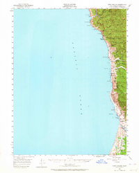
1950 Map of Cape Vizcaino
USGS Topo · Published 1964About this map
Cape Vizcaino anchors this coastal survey, where the Mendocino shoreline meets the steep, timbered ridges of the Northern California coast. Small coastal settlements such as Rockport, Westport, and Hardy are connected by the winding path of State Highway 1, illustrating the early mid-century transportation network that served these isolated communities. Along the coast, numerous landmarks like Abalone Point and Sea Lion Rock define the maritime edge, while inland, a series of parallel ridges including Cottoneva Ridge and Packard Ridge separate the many westward-flowing drainages. Genealogists and local historians can locate specific social centers like the Ft Bragg Grange and a Cemetery near Union Landing. The southern portion of the map is dominated by the broad delta-like drainage of the Tenmile River and the small hamlet of Inglenook, showing the transition from steep bluffs to more open coastal terrace land.
Find a feature on this map
47 named features on this map. Tap any name to fly to it.
Don’t see what you’re looking for? This feature index may not catch every label — zoom into the map to look around manually.
Map Details
Editions of this 1950 Cape Vizcaino Map
2 editions found
Other maps of this area

1920 · Glenblair
USGS Topo · 1:62,500

1920 · Cummings
USGS Topo · 1:62,500

1920 · Fort Bragg
USGS Topo · 1:62,500

1921 · Westport
USGS Topo · 1:62,500

1921 · Branscomb
USGS Topo · 1:62,500

1943 · Glenblair
USGS Topo · 1:62,500

1943 · Fort Bragg
USGS Topo · 1:62,500

1950 · Piercy
USGS Topo · 1:62,500

1950 · Cape Vizcaino
USGS Topo · 1:62,500

1951 · Cape Vizcaino
USGS Topo · 1:62,500