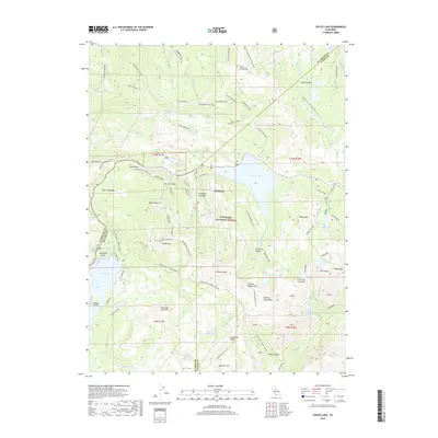
2018 Map of Caples Lake
USGS Topo · Published 2018About this map
Kirkwood sits at the heart of this high-altitude landscape, where the borders of El Dorado, Amador, and Alpine counties converge within the Eldorado National Forest. The 2018 survey reveals a terrain defined by glacial lakes and granite peaks, with Caples Lake and Silver Lake serving as major hydrological landmarks. Transportation and recreation are centered on a dense network of mountain routes, including the Pacific Crest National Scenic Trail and the Tahoe Rim Trail, alongside rugged paths like the Strawberry 4WD Trail. The map documents the specific alpine geography of the Sierra Nevada, from the volcanic formations of Thunder Mountain and The Sisters to the curious geologic features of the Machado Postpiles. Large basins such as Kirkwood Meadows and Emigrant Valley illustrate the open meadowlands that have long supported seasonal activity in this demanding environment.
Find a feature on this map
78 named features on this map. Tap any name to fly to it.
Don’t see what you’re looking for? This feature index may not catch every label — zoom into the map to look around manually.
Map Details
Editions of this 2018 Caples Lake Map
This is the sole edition of this map. No revisions or reprints were ever made.
Other maps of this area

1889 · Pyramid Peak
USGS Topo · 1:125,000

1889 · Markleeville
USGS Topo · 1:125,000

1891 · Markleeville
USGS Topo · 1:125,000

1891 · Pyramid Peak
USGS Topo · 1:125,000

1893 · Markleeville
USGS Topo · 1:125,000

1895 · Pyramid Peak
USGS Topo · 1:125,000

1896 · Pyramid Peak
USGS Topo · 1:125,000

1947 · Sacramento
USGS Topo · 1:250,000

1948 · Walker Lake
USGS Topo · 1:250,000

1948 · Sacramento
USGS Topo · 1:250,000