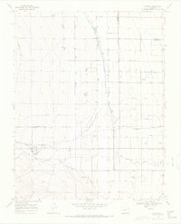
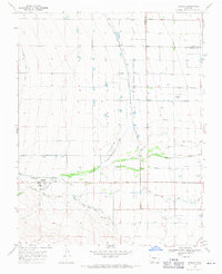
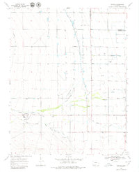
1968 Map of Capulin
USGS Topo · Published 1971About this map
The Alamosa River and La Jara Creek define the hydrology of this southern Colorado landscape, where an intricate system of hand-labeled irrigation works supports the high-altitude agriculture of the late 1960s. The settlement of Capulin serves as the local hub, flanked by the Capulin Cem and St Josephs Cem. To the north and east, the map reveals smaller community clusters at Morgan and Morganville, which are connected by the Morganville Ditch and Morgan Drain.
Find a feature on this map
28 named features on this map. Tap any name to fly to it.
Don’t see what you’re looking for? This feature index may not catch every label — zoom into the map to look around manually.
Map Details
Editions of this 1968 Capulin Map
3 editions found
Other maps of this area
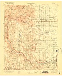
1922 · Conejos
USGS Topo · 1:125,000

1945 · Durango
USGS Topo · 1:250,000

1953 · Durango
USGS Topo · 1:250,000

1954 · Durango
USGS Topo · 1:250,000

1954 · Trinidad
USGS Topo · 1:250,000

1955 · Trinidad
USGS Topo · 1:250,000

1958 · Trinidad
USGS Topo · 1:250,000

1959 · Trinidad
USGS Topo · 1:250,000

1961 · Durango
USGS Topo · 1:250,000

1963 · Durango
USGS Topo · 1:250,000