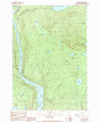
1989 Map of Caratunk
USGS Topo · Published 1989About this map
Caratunk and the surrounding wilderness of Somerset County are defined by the winding course of the Kennebec River, which expands here into the waters of Wyman Lake. This 1989 provisional survey shows a landscape of water and high ridges, where the Appalachian Trail crosses the river corridor near the settlement. The map provides clear evidence of the region’s dual identity as both a recreational corridor and a site of industrial extraction, marked by a series of Gravel Pits and Shale Pits alongside a noted Historic Site near the lakeshore. Dense topographic contours trace the rise of Moxie Mountain and Black Nubble, framing a network of smaller water bodies such as Pleasant Pond, Chase Pond, and Macdougall Pond. This specific moment in the late 1980s documents the local infrastructure of the river valley, from the small Cem near the village to the Boat Launch facilities that serve the lake.
Find a feature on this map
47 named features on this map. Tap any name to fly to it.
Don’t see what you’re looking for? This feature index may not catch every label — zoom into the map to look around manually.
Map Details
Editions of this 1989 Caratunk Map
This is the sole edition of this map. No revisions or reprints were ever made.
Other maps of this area

1903 · Bingham
USGS Topo · 1:62,500

1905 · Bingham
USGS Topo · 1:62,500

1905 · The Forks
USGS Topo · 1:62,500

1907 · The Forks
USGS Topo · 1:62,500

1925 · Pierce Pond
USGS Topo · 1:48,000

1927 · Pierce Pond
USGS Topo · 1:62,500

1928 · Dead River
USGS Topo · 1:62,500

1931 · Dead River
USGS Topo · 1:48,000

1944 · Dead River
USGS Topo · 1:62,500

1944 · Pierce Pond
USGS Topo · 1:62,500