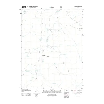
2011 Map of Carbonate
USGS Topo · Published 2011About this map
Grizzly Cow Camp and Hip Roof Camp sit within a high-elevation drainage system defined by the headwaters of Grizzly Creek and the curiously named No Name Creek. This 2011 survey of the Carbonate quadrangle reveals a landscape where seasonal livestock camps and established paths like the Transfer Trail and Coffee Pot Rd provide the primary human imprint on the terrain. The topography is dominated by dramatic geological features including Quartzite Ridge and the summit of Baxter Peak, which rises above a series of alpine water bodies like White Owl Lake, Ute Lake, and Haypress Lake. The network of creeks, including South Grizzly Creek and East No Name Creek, illustrates the complex hydrology of the Elbow Park region, serving as a detailed record of the backcountry geography in Garfield County.
Find a feature on this map
32 named features on this map. Tap any name to fly to it.
Don’t see what you’re looking for? This feature index may not catch every label — zoom into the map to look around manually.
Map Details
Editions of this 2011 Carbonate Map
This is the sole edition of this map. No revisions or reprints were ever made.
Other maps of this area

1927 · Glenwood Springs
USGS Topo · 1:125,000

1930 · Glenwood Springs
USGS Topo · 1:125,000

1957 · Leadville
USGS Topo · 1:250,000

1959 · Leadville
USGS Topo · 1:250,000

1960 · Leadville
USGS Topo · 1:250,000

1961 · Shoshone
USGS Topo · 1:24,000

1961 · Glenwood Springs
USGS Topo · 1:24,000

1962 · Leadville
USGS Topo · 1:250,000

1962 · Storm King Mountain
USGS Topo · 1:24,000

1964 · Leadville
USGS Topo · 1:250,000