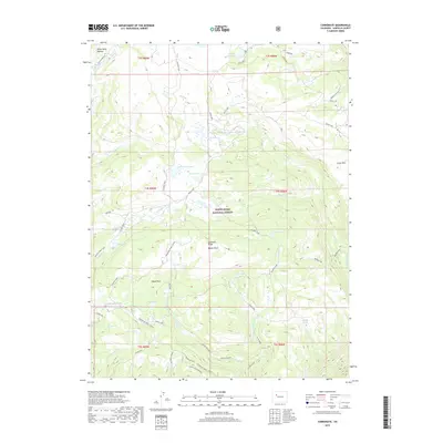
2019 Map of Carbonate
USGS Topo · Published 2019About this map
The high-elevation White River Plateau dominates this portion of the White River National Forest, defined by a network of seasonal routes and numerous alpine lakes. Local navigation centers on the Transfer Trail, which winds past Blair Mountain and connects several high mountain basins. The landscape is dotted with named water bodies such as White Owl Lake, Grizzly Lake, and Monument Lake, illustrating the drainage patterns that feed into Grizzly Cr and No Name Cr.
Find a feature on this map
46 named features on this map. Tap any name to fly to it.
Don’t see what you’re looking for? This feature index may not catch every label — zoom into the map to look around manually.
Map Details
Editions of this 2019 Carbonate Map
This is the sole edition of this map. No revisions or reprints were ever made.
Other maps of this area

1927 · Glenwood Springs
USGS Topo · 1:125,000

1930 · Glenwood Springs
USGS Topo · 1:125,000

1957 · Leadville
USGS Topo · 1:250,000

1959 · Leadville
USGS Topo · 1:250,000

1960 · Leadville
USGS Topo · 1:250,000

1961 · Shoshone
USGS Topo · 1:24,000

1961 · Glenwood Springs
USGS Topo · 1:24,000

1962 · Leadville
USGS Topo · 1:250,000

1962 · Storm King Mountain
USGS Topo · 1:24,000

1964 · Leadville
USGS Topo · 1:250,000