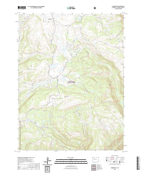
2022 Map of Carbonate
USGS Topo · Published 2022About this map
Carbonate sits high on the plateau, a focal point for a landscape defined by its network of historic paths and high alpine lakes. This 2022 survey captures the rugged backcountry within the White River National Forest, where the Transfer Trl and Ute Lake Trl serve as the primary conduits through the complex terrain of Tibbetts Ridge and Quartzite Ridge. The area is a mosaic of small water bodies like Yellow Lake and Haypress Lake situated between high summits such as Blair Mountain and Storm King.
Find a feature on this map
51 named features on this map. Tap any name to fly to it.
Don’t see what you’re looking for? This feature index may not catch every label — zoom into the map to look around manually.
Map Details
Editions of this 2022 Carbonate Map
This is the sole edition of this map. No revisions or reprints were ever made.
Other maps of this area

1927 · Glenwood Springs
USGS Topo · 1:125,000

1930 · Glenwood Springs
USGS Topo · 1:125,000

1957 · Leadville
USGS Topo · 1:250,000

1959 · Leadville
USGS Topo · 1:250,000

1960 · Leadville
USGS Topo · 1:250,000

1961 · Shoshone
USGS Topo · 1:24,000

1961 · Glenwood Springs
USGS Topo · 1:24,000

1962 · Leadville
USGS Topo · 1:250,000

1962 · Storm King Mountain
USGS Topo · 1:24,000

1964 · Leadville
USGS Topo · 1:250,000