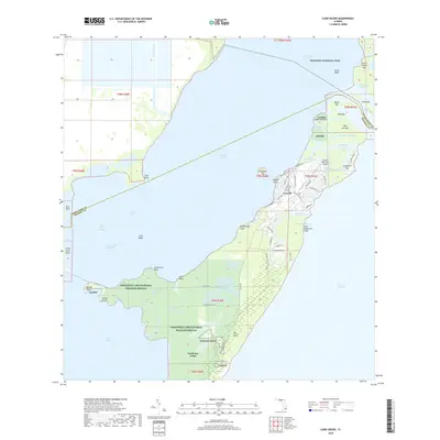
2018 Map of Card Sound
USGS Topo · Published 2018About this map
North Key Largo and the private enclave of Grayvik anchor the southern portion of this coastal survey, where the terrestrial environment is largely protected by the Crocodile Lake National Wildlife Refuge. The map details a complex interface of land and sea, tracing the winding paths of Broad Creek and Angelfish Creek as they cut between the northernmost Florida Keys. To the north, the expanse of Biscayne National Park begins, covering submerged features like Cutter Bank and numerous small islands such as Palo Alto Key and Rose Key.
Find a feature on this map
85 named features on this map. Tap any name to fly to it.
Don’t see what you’re looking for? This feature index may not catch every label — zoom into the map to look around manually.
Map Details
Editions of this 2018 Card Sound Map
This is the sole edition of this map. No revisions or reprints were ever made.
Other maps of this area

1947 · Garden Cove
USGS Topo · 1:24,000

1947 · Blackwater Sound
USGS Topo · 1:24,000

1949 · Blackwater Sound
USGS Topo · 1:24,000

1949 · Garden Cove
USGS Topo · 1:24,000

1949 · Elliott Key
USGS Topo · 1:24,000

1949 · Card Sound
USGS Topo · 1:24,000

1949 · Pacific Reef
USGS Topo · 1:24,000

1949 · Arsenicker Keys
USGS Topo · 1:24,000

1950 · Homestead
USGS Topo · 1:24,000

1950 · Glades
USGS Topo · 1:24,000