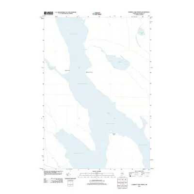
2011 Map of Caribou Lake North
USGS Topo · Published 2011About this map
Chesuncook Lake dominates this northern Piscataquis County landscape, a central hub for the Maine North Woods' timber and waterway networks in the early 21st century. The map details the expansive shoreline of this important reservoir, tracing the intricate boundaries of Sandy Point, Weymouth Point, and Caribou Point. Unlike more developed regions, this area is characterized by vast tracts of forest and water, with Foster Field standing out as a rare named terrestrial clearing amidst the timberlands. The hydrological system is meticulously charted, showing how Mud Pond and Ripogenus Pond connect via Mud Brook and the West Branch Ripogenus Stream. For those studying the geography of the Penobscot River watershed, these connections illustrate the flow of water through a region long-defined by its wilderness character and seasonal resource industry.
Find a feature on this map
11 named features on this map. Tap any name to fly to it.
Don’t see what you’re looking for? This feature index may not catch every label — zoom into the map to look around manually.
Map Details
Editions of this 2011 Caribou Lake North Map
This is the sole edition of this map. No revisions or reprints were ever made.
Other maps of this area

1953 · Telos Lake
USGS Topo · 1:62,500

1954 · Chesuncook
USGS Topo · 1:62,500

1954 · Grant Farm
USGS Topo · 1:62,500

1954 · Harrington Lake
USGS Topo · 1:62,500

1954 · Presque Isle
USGS Topo · 1:250,000

1954 · Millinocket
USGS Topo · 1:250,000

1957 · Telos Lake
USGS Topo · 1:62,500

1958 · Presque Isle
USGS Topo · 1:250,000

1958 · Millinocket
USGS Topo · 1:250,000

1958 · Chesuncook
USGS Topo · 1:62,500