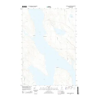
2014 Map of Caribou Lake North
USGS Topo · Published 2014About this map
Chesuncook Lake dominates this northern Piscataquis County landscape, a critical waterway in the North Maine Woods. This 2014 survey captures the intricate shoreline where Sandy Point and Weymouth Point reach into the central expanse of the lake. To the south, the waters of Caribou Lake are separated from the main body by Caribou Point, connected by a narrow passage.
Find a feature on this map
17 named features on this map. Tap any name to fly to it.
Don’t see what you’re looking for? This feature index may not catch every label — zoom into the map to look around manually.
Map Details
Editions of this 2014 Caribou Lake North Map
This is the sole edition of this map. No revisions or reprints were ever made.
Other maps of this area

1953 · Telos Lake
USGS Topo · 1:62,500

1954 · Chesuncook
USGS Topo · 1:62,500

1954 · Grant Farm
USGS Topo · 1:62,500

1954 · Harrington Lake
USGS Topo · 1:62,500

1954 · Presque Isle
USGS Topo · 1:250,000

1954 · Millinocket
USGS Topo · 1:250,000

1957 · Telos Lake
USGS Topo · 1:62,500

1958 · Presque Isle
USGS Topo · 1:250,000

1958 · Millinocket
USGS Topo · 1:250,000

1958 · Chesuncook
USGS Topo · 1:62,500