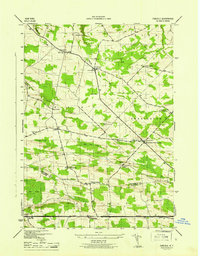
1945 Map of Carlisle
USGS Topo · Published 1945About this map
The boundary between Montgomery Co Schoharie Co divides this 1940s landscape, where rural life is anchored by a dense network of district schools and family cemeteries. The southern portion is dominated by the historic Cherry Valley Turnpike running through Carlisle, while the northern hills are drained by Yatesville Creek and Flat Creek. Small agricultural crossroads like Rural Grove, Charleston Four Corners, and Lykers suggest a community of tightly-knit hamlets, each supported by its own infrastructure such as School No 11 and the Bratt School. The topography is marked by significant wetlands, including Bear Swamp and Little Bear Swamp, which shaped the road patterns and settlement sites. Genealogists will find particular value in the clearly marked burial grounds, including the Friends Cem, Gove Cem, and Haight Cem, which are often the only remaining markers of the area's earliest families.
Find a feature on this map
33 named features on this map. Tap any name to fly to it.
Don’t see what you’re looking for? This feature index may not catch every label — zoom into the map to look around manually.
Map Details
Editions of this 1945 Carlisle Map
This is the sole edition of this map. No revisions or reprints were ever made.
Other maps of this area

1896 · Fonda
USGS Topo · 1:62,500

1898 · Fonda
USGS Topo · 1:62,500

1898 · Canajoharie
USGS Topo · 1:62,500

1898 · Schoharie
USGS Topo · 1:62,500

1900 · Canajoharie
USGS Topo · 1:62,500

1900 · Schoharie
USGS Topo · 1:62,500

1900 · Schoharie
USGS Topo · 1:31,680

1902 · Canajoharie
USGS Topo · 1:62,500

1902 · Fonda
USGS Topo · 1:62,500

1904 · Richmondville
USGS Topo · 1:62,500