
Loading...
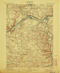
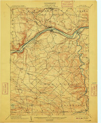
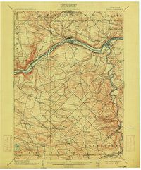
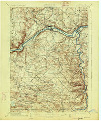
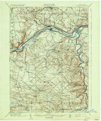
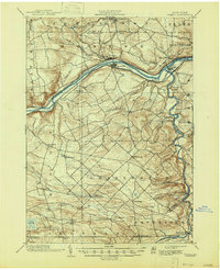
Loading map...1902 Map of Fonda
USGS Topo · Published 1902About this map
The Mohawk River corridor serves as the primary artery for transportation and industry at the turn of the century, with the Erie Canal and competing rail lines running parallel along its banks. This 1890s survey documents a landscape defined by water power and transit, where the New York Central and Hudson River and the West Shore R. R. connect the manufacturing hubs of Fonda and Fultonville.
Find a feature on this map
54 named features on this map. Tap any name to fly to it.
Don’t see what you’re looking for? This feature index may not catch every label — zoom into the map to look around manually.
Map Details
Date Portrayed1902
Date Published1902
PublisherU.S. Geological Survey
Map TypeTopographic
Scale1:62,500
Physical Dimensions16.6 x 20.1 inches
Editions of this 1902 Fonda Map
8 editions found

Historical Maps of Johnstown Through Time
3 maps found


Featured Locations
Source Details
SourceU.S. Geological Survey
CopyrightPublic Domain