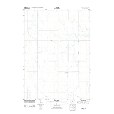
2012 Map of Carlock
USGS Topo · Published 2012About this map
Carlock serves as the central settlement in this Gregory County landscape, situated along the intersection of SD Hwy 251 and Cor D 14. The region is defined by a dendritic drainage pattern where several creeks, including Murphy Cr, Indian Cr, and Shingle Cr, cut through the plains. The social and genealogical history of this rural community is anchored by several distinct burial grounds, such as Peace Cem, Congregational Cem, and the German Congregation Cem. These sites, along with the section-line road network of Co Hwy-40 and Co Hwy-35, illustrate the organized land division and enduring community ties in south-central South Dakota near the Nebraska border.
Find a feature on this map
18 named features on this map. Tap any name to fly to it.
Don’t see what you’re looking for? This feature index may not catch every label — zoom into the map to look around manually.
Map Details
Editions of this 2012 Carlock Map
This is the sole edition of this map. No revisions or reprints were ever made.
Other maps of this area

1955 · Mitchell
USGS Topo · 1:250,000

1955 · O'Neill
USGS Topo · 1:250,000

1959 · O'Neill
USGS Topo · 1:250,000

1959 · Mitchell
USGS Topo · 1:250,000

1964 · Gregory SE
USGS Topo · 1:24,000

1964 · Mills
USGS Topo · 1:24,000

1964 · Gregory
USGS Topo · 1:24,000

1964 · Dallas
USGS Topo · 1:24,000

1964 · Paxton
USGS Topo · 1:24,000
1964 · Burton
USGS Topo · 1:24,000