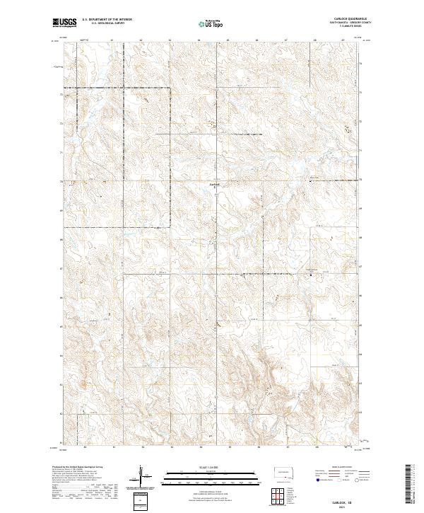
2021 Map of Carlock
USGS Topo · Published 2021About this map
Carlock serves as the central hub of this rural landscape in Gregory County, situated at the intersection of Co Rd 15 and Co Rd 14. The terrain is defined by a dendritic network of drainages including Indian Cr and Murphy Cr, which carve through the high plains of southern South Dakota. This 2021 survey illustrates the enduring grid system of the Great Plains, where section lines dictate the path of local routes like 334th Ave and 300th St.
Find a feature on this map
34 named features on this map. Tap any name to fly to it.
Don’t see what you’re looking for? This feature index may not catch every label — zoom into the map to look around manually.
Map Details
Editions of this 2021 Carlock Map
This is the sole edition of this map. No revisions or reprints were ever made.
Other maps of this area

1955 · Mitchell
USGS Topo · 1:250,000

1955 · O'Neill
USGS Topo · 1:250,000

1959 · O'Neill
USGS Topo · 1:250,000

1959 · Mitchell
USGS Topo · 1:250,000

1964 · Gregory SE
USGS Topo · 1:24,000

1964 · Mills
USGS Topo · 1:24,000

1964 · Gregory
USGS Topo · 1:24,000

1964 · Dallas
USGS Topo · 1:24,000

1964 · Paxton
USGS Topo · 1:24,000
1964 · Burton
USGS Topo · 1:24,000