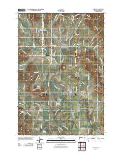
2011 Map of Carlton
USGS Topo · Published 2011About this map
Yamhill and Carlton anchor this 2011 survey of agricultural Yamhill County, where the valley floor transitions into the eastern foothills of the Coast Range. The landscape is defined by the winding course of the North Yamhill River and its many tributaries, including Yamhill Creek, Stag Hollow Creek, and Rowland Creek. This area's long-standing agrarian character is evident in the numerous family-named irrigation features, such as the Fidel Brothers Irrigation Reservoir and Sitton Reservoir. Local history and genealogy researchers will find significant landmarks across the quadrangle, from the McBride Cemetery west of Carlton to the Yamhill-Carlton Cemetery and the edge of Lafayette Cemetery. The map also traces the legacy of early transportation with NW Old Railroad Grade Rd, alongside the small residential pockets of Cove Orchard and Lunnville. Diverse terrain features like Alecs Butte break the rolling valley floor, while the Trivelpiece Airport provides a localized landmark for 21st-century aviation.
Find a feature on this map
88 named features on this map. Tap any name to fly to it.
Don’t see what you’re looking for? This feature index may not catch every label — zoom into the map to look around manually.
Map Details
Editions of this 2011 Carlton Map
This is the sole edition of this map. No revisions or reprints were ever made.
Other maps of this area

1924 · Mc Minnville
USGS Topo · 1:48,000

1926 · Mc Minnville
USGS Topo · 1:62,500

1940 · McMinnville
USGS Topo · 1:62,500

1941 · Yamhill
USGS Topo · 1:62,500

1942 · Sheridan
USGS Topo · 1:62,500

1942 · Yamhill
USGS Topo · 1:62,500

1942 · Fairdale
USGS Topo · 1:62,500

1948 · Vancouver
USGS Topo · 1:250,000

1950 · Vancouver
USGS Topo · 1:250,000

1950 · Vancouver
USGS Topo · 1:250,000