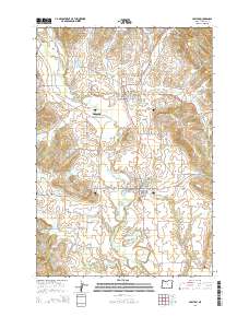
2014 Map of Carlton
USGS Topo · Published 2014About this map
Carlton and Yamhill serve as the primary hubs of this agricultural landscape in Yamhill County, where the North Yamhill River and its various tributaries like Stag Hollow Cr and Panther Cr dictate the layout of vineyards and farms. The map reveals a high density of water management features essential to the region's viticulture and farming, including the Fidel Brothers Irrigation Reservoir, Oberg Reservoir, and Gidding Reservoir.
Find a feature on this map
138 named features on this map. Tap any name to fly to it.
Don’t see what you’re looking for? This feature index may not catch every label — zoom into the map to look around manually.
Map Details
Editions of this 2014 Carlton Map
This is the sole edition of this map. No revisions or reprints were ever made.
Other maps of this area

1924 · Mc Minnville
USGS Topo · 1:48,000

1926 · Mc Minnville
USGS Topo · 1:62,500

1940 · McMinnville
USGS Topo · 1:62,500

1941 · Yamhill
USGS Topo · 1:62,500

1942 · Sheridan
USGS Topo · 1:62,500

1942 · Yamhill
USGS Topo · 1:62,500

1942 · Fairdale
USGS Topo · 1:62,500

1948 · Vancouver
USGS Topo · 1:250,000

1950 · Vancouver
USGS Topo · 1:250,000

1950 · Vancouver
USGS Topo · 1:250,000