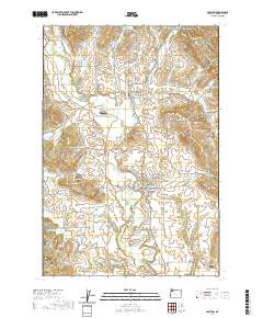
2020 Map of Carlton
USGS Topo · Published 2020About this map
The North Yamhill River and its various tributaries, including Rowland Cr and Yamhill Cr, define the agricultural and residential landscape of this Yamhill County corridor. The townships of Carlton and Yamhill serve as the primary hubs, surrounded by smaller communities such as Lunnville and Cove Orchard. The area's focus on water management is evident through numerous named catchments like the Fidel Brothers Irrigation Reservoir, Sitton Reservoir, and Oberg Reservoir, which support the local valley farms. For genealogists and local historians, the map identifies significant burial sites including the Yamhill - Carlton Cem and McBride Cem. The presence of the NW Old Railroad Grade RD traces the path of former transport infrastructure, while the small Trivelpiece Airport and landmarks like Alecs Butte provide distinct points of reference across the low-lying terrain.
Find a feature on this map
103 named features on this map. Tap any name to fly to it.
Don’t see what you’re looking for? This feature index may not catch every label — zoom into the map to look around manually.
Map Details
Editions of this 2020 Carlton Map
This is the sole edition of this map. No revisions or reprints were ever made.
Other maps of this area

1924 · Mc Minnville
USGS Topo · 1:48,000

1926 · Mc Minnville
USGS Topo · 1:62,500

1940 · McMinnville
USGS Topo · 1:62,500

1941 · Yamhill
USGS Topo · 1:62,500

1942 · Sheridan
USGS Topo · 1:62,500

1942 · Yamhill
USGS Topo · 1:62,500

1942 · Fairdale
USGS Topo · 1:62,500

1948 · Vancouver
USGS Topo · 1:250,000

1950 · Vancouver
USGS Topo · 1:250,000

1950 · Vancouver
USGS Topo · 1:250,000