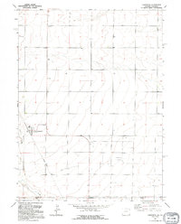
1991 Map of Carpenter
USGS Topo · Published 1995About this map
Carpenter sits at the heart of this high-plains landscape, situated just north of the Wyoming-Colorado state line. The settlement serves as a focal point in an otherwise sparse agricultural region, marked by the presence of a local Cem and the winding path of Crow Creek to the southwest. A significant structural relic of the area's transportation history is the Old Railroad Grade, which angles across the terrain, tracing a path that once connected these borderland communities to larger rail networks. The map details the transition between Laramie County and Weld County, capturing a quiet period where the landscape is defined more by its surveying section lines and scattered water wells than by dense development.
Find a feature on this map
8 named features on this map. Tap any name to fly to it.
Don’t see what you’re looking for? This feature index may not catch every label — zoom into the map to look around manually.
Map Details
Editions of this 1991 Carpenter Map
This is the sole edition of this map. No revisions or reprints were ever made.
Other maps of this area

1954 · Cheyenne
USGS Topo · 1:250,000

1954 · Greeley
USGS Topo · 1:250,000

1957 · Greeley
USGS Topo · 1:250,000

1958 · Cheyenne
USGS Topo · 1:250,000

1958 · Greeley
USGS Topo · 1:250,000

1961 · Greeley
USGS Topo · 1:250,000

1963 · Arcola
USGS Topo · 1:24,000

1963 · Burns
USGS Topo · 1:24,000

1963 · Carpenter
USGS Topo · 1:24,000

1963 · Pine Bluffs SW
USGS Topo · 1:24,000