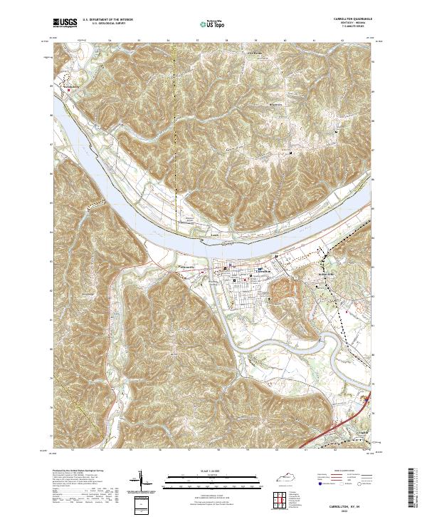
2022 Map of Carrollton
USGS Topo · Published 2022About this map
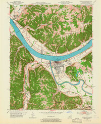
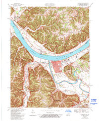
The confluence of the Kentucky River and the Ohio River anchors this landscape, where the historic settlement of Carrollton stands as the primary hub of activity. The river-oriented infrastructure is evident at Craw Daddy Landing and the specialized facilities of the William L Wheeler Hall of Justice. Surrounding the town, the topography is defined by prominent ridges such as Splinter Ridge, Rocket Ridge, and Kings Ridge, which separate the various drainage basins of Little Doe Run, Green Valley Cr, and Lost Fork Cr.
Find a feature on this map
128 named features on this map. Tap any name to fly to it.
Don’t see what you’re looking for? This feature index may not catch every label — zoom into the map to look around manually.
Map Details
Editions of this 2022 Carrollton Map
This is the sole edition of this map. No revisions or reprints were ever made.
Historical Maps of Lamb Through Time
3 maps found