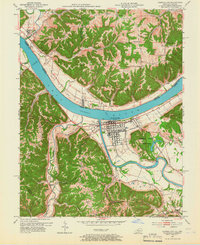
1953 Map of Carrollton
USGS Topo · Published 1966About this map
The Ohio River dominates this mid-century survey, serving as the broad dividing line between Indiana and Kentucky. At its prominent bend, Carrollton sits at the confluence where the Kentucky River flows into the Ohio, its grid-style streets anchored by the I O O F Cem and nearby Lock No 1. Across the water in Indiana, the landscape is defined by the steep rises of Milton and the Bracket Ridge, while the Kentucky side features the recreational grounds of General Butler State Park.
Find a feature on this map
57 named features on this map. Tap any name to fly to it.
Don’t see what you’re looking for? This feature index may not catch every label — zoom into the map to look around manually.
Map Details
Editions of this 1953 Carrollton Map
2 editions found
Other maps of this area

1943 · Vevay North
USGS Topo · 1:24,000

1943 · Brooksburg
USGS Topo · 1:24,000

1943 · Vevay South
USGS Topo · 1:24,000

1952 · Vevay South
USGS Topo · 1:24,000

1952 · Worthville
USGS Topo · 1:24,000

1952 · Campbellsburg
USGS Topo · 1:24,000

1953 · Bedford
USGS Topo · 1:24,000

1953 · Carrollton
USGS Topo · 1:24,000

1953 · Madison East
USGS Topo · 1:24,000

1956 · Bennington
USGS Topo · 1:24,000