
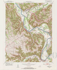
1952 Map of Worthville
USGS Topo · Published 1954About this map
The Kentucky River carves a deep, winding path through this northern Kentucky landscape, defining the borders where Carroll, Henry, and Owen Counties meet. At the confluence of Eagle Creek, the town of Worthville sits at a vital transportation juncture, where the Louisville and Nashville railroad tracks parallel the water. This 1950s survey captures a rural river-valley economy transitioning into the mid-century, with scattered settlements like Port Royal and Moxley connected by narrow ridge roads and creek-bottom lanes.
Find a feature on this map
26 named features on this map. Tap any name to fly to it.
Don’t see what you’re looking for? This feature index may not catch every label — zoom into the map to look around manually.
Map Details
Editions of this 1952 Worthville Map
3 editions found
Other maps of this area

1906 · Lockport
USGS Topo · 1:48,000

1908 · Lockport
USGS Topo · 1:62,500

1928 · New Castle
USGS Topo · 1:48,000

1932 · New Castle
USGS Topo · 1:62,500

1943 · Brooksburg
USGS Topo · 1:24,000

1943 · Vevay South
USGS Topo · 1:24,000

1950 · New Liberty
USGS Topo · 1:24,000

1951 · Sanders
USGS Topo · 1:24,000

1952 · Vevay South
USGS Topo · 1:24,000

1952 · Campbellsburg
USGS Topo · 1:24,000