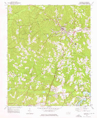
1974 Map of Carthage
USGS Topo · Published 1976About this map
Carthage serves as the hub of this Moore County landscape, where the town's expansion meets the protected woodlands of the Goodwin State Forest. The mid-1970s terrain is defined by a network of rural crossroads and community centers, including Pleasantville, Hill Crest, and Eastwood. Local genealogy is deeply rooted in the many country churches scattered across the quadrangle, such as Bethlehem Ch, Mt Olive Ch, and Doubs Chapel. To the southeast, the development of Whispering Pines introduces a different character to the land, featuring Spring Valley Lake, Thagards Lake, and recreational golf courses. The drainage patterns of McLendons Creek, Wads Creek, and the Little River organize the topography, while landmarks like the Fairgrounds near Carthage and the Farm Life Sch reflect the area's agricultural and civic foundations.
Find a feature on this map
33 named features on this map. Tap any name to fly to it.
Don’t see what you’re looking for? This feature index may not catch every label — zoom into the map to look around manually.
Map Details
Editions of this 1974 Carthage Map
2 editions found
Other maps of this area

1942 · Troy
USGS Topo · 1:125,000

1948 · Southern Pines
USGS Topo · 1:62,500

1949 · West End
USGS Topo · 1:24,000

1949 · Jackson Springs
USGS Topo · 1:62,500

1950 · Niagara
USGS Topo · 1:24,000

1950 · Southern Pines
USGS Topo · 1:24,000

1953 · Raleigh
USGS Topo · 1:250,000

1954 · Raleigh
USGS Topo · 1:250,000

1957 · Southern Pines
USGS Topo · 1:62,500
1957 · Southern Pines
USGS Topo · 1:24,000